
November 1, 2019
Hennepin History Museum’s archive collection of Minnesota Department of Transportation (MnDOT) materials offers a glimpse into the world of highway construction planning. The materials in the collection are mainly impartial data collected for right of way surveys done in the 1950s through the 1970s. This small snapshot into the workings of MnDOT documents an early stage in the process of planning for roadway development; namely the acquisition of land.
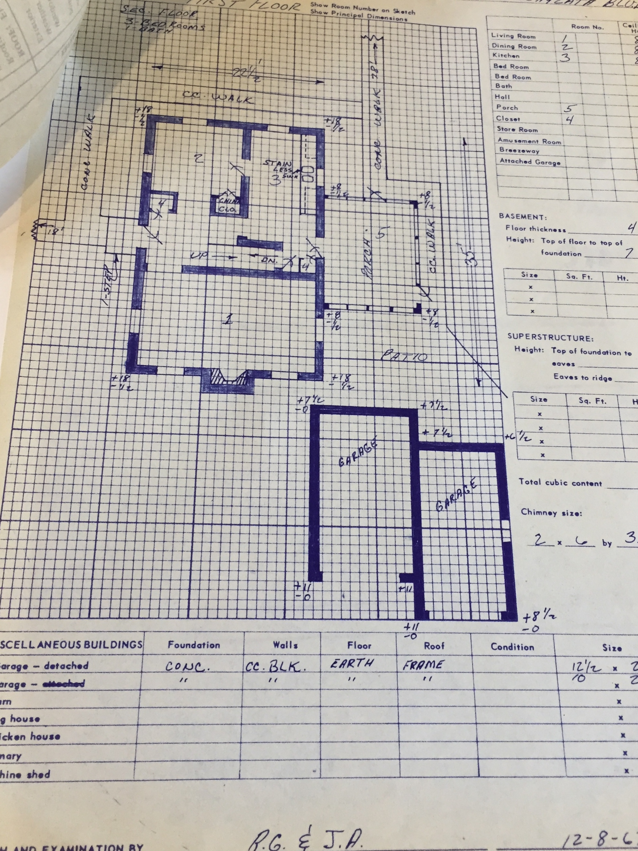
Image from HHM Archives
Planning for Minnesota’s state highway system began in 1905 when the Minnesota legislature created the State Highway Commission. In 1917, the Highway Commission became the Department of Highways. The funding for a 70-trunk highway system plan was passed by the State Legislation in 1920s: the Department of Highways was charged with constructing and maintaining the new highway system and was given a mandate by the State Legislature to acquire right of ways for projects.
According to MnDOT, right of way refers to “a strip of land which is used as a transportation corridor. The land is acquired as an easement or in fee, either by agreement or condemnation.” HHM’s MnDOT archive collection includes duplicates of some of the surveys done by the Right of Way division of the Department of Highways within Hennepin County. The collection covers parts of Highway 55/Hiawatha Avenue, Interstate 94 north of downtown Minneapolis, Highway 100 and several smaller segments located along Highways 12, 55/Olson Memorial, 169 and 36. The information for each property address in the collection may include any or all of the following:
- Photographs of the exterior of the structures, often a set of three or more including a front view, back view and outbuilding or garage view.
- Forms from the Minnesota Department of Highways Right of Way Division outlining the composition of the structures located at the address.
- Floorplans of the structures.
- Other miscellaneous information about the property.
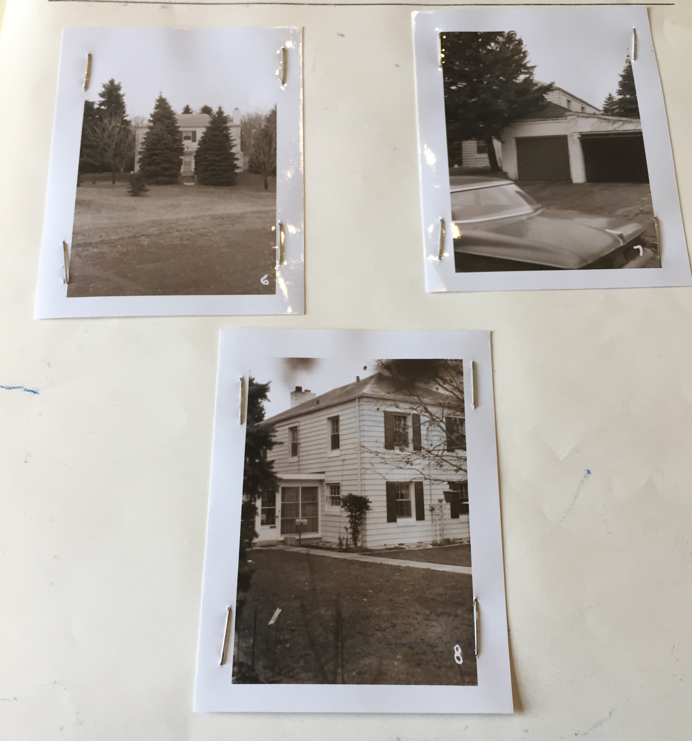
Image from HHM Archives
The collection provides information on over 1,300 addresses and includes over 3,000 photographs. Most of the surveys are of residential properties but there are also a fair number of businesses featured, especially along Highway 55/Hiawatha. One of the properties demolished for Interstate 94 was St. Joseph’s Church, which was located in what is now known as Near North in Minneapolis. The floorplan featured here shows a diagram of the original structure and provides an example of the materials within this collection.
In 1976, the Department of Highways experienced a second name change, becoming the Minnesota Department of Transportation (MnDOT) that we know today. MnDOT continues to develop and implement policies, plans, and programs for aeronautics, highways, motor carriers, ports, public transit, railroads, and pipelines. The department also constructs, maintains, and regulates transportation facilities and services.
This archive collection is processed with a complete finding aid, and is available to researchers with an appointment by contacting the HHM Archivist. This collection was processed in part with funds provided by the State of Minnesota from the Arts and Cultural Heritage Fund through the Minnesota Historical Society.
Written by Michele Hagen, Processing Archivist
References
History of MnDOT. http://www.dot.state.mn.us/information/history.html
MnDOT Right of Way acquisition. https://www.dot.state.mn.us/row/index.html